We’re within 24 hours of another serious spring storm delivering blizzard conditions to southern Minnesota. Here’s where things stand Tuesday morning.
- Areas south of the Twin Cities are going to get smacked.
- 50 mph gusts and 1-2 inches of snow per hour are expected.
- Models trending south, which would spare the Twin Cities from the worst
The worst conditions are expected Wednesday morning, and the National Weather Service has issued a blizzard warning to account for the likelihood of very heavy snow and high winds.
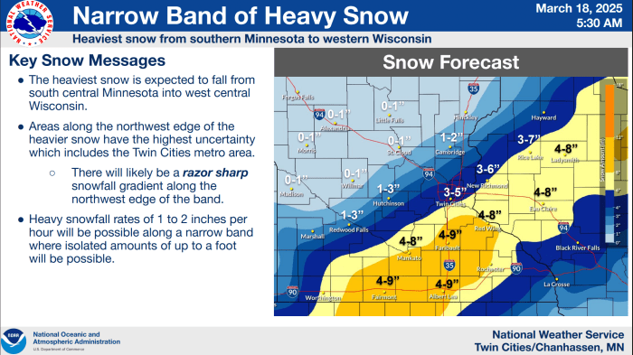
“A band of heavy snow will develop across the region early Wednesday morning and last through Wednesday evening. This will start as rain, and quickly transition to a heavy, wet snow, with snowfall rates of an inch per hour or greater at times. Amounts around 4 to 9 inches are expected under the axis of heaviest snow, with isolated pockets up to a foot possible,” the weather service says.
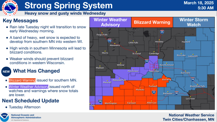
“In addition to the heavy snow, northerly winds of 30 to 40 mph will develop causing blowing and drifting snow. In south central Minnesota, wind gusts could exceed 45 mph, which could lead to whiteout conditions,” the NWS added in the warning.

Because of uncertainty in the precise location of the axis of heavy snow—and the expectation of a “razor sharp” cutoff on the northwest side of the snow—the NWS has put the northwest half of the metro in a winter weather advisory, while maintaining a winter storm watch for the southeastern half of the metro.
The official snowfall forecast from the NWS calls for 3-5 inches in the Twin Cities.
But the models have trended further southeast. In fact, if the models are accurate, parts of the metro could get skunked.
Bring Me The News meteorologist Sven Sundgaard is monitoring the situation, and in text messages with him Tuesday morning he said 1-6 inches is a fair range for the metro, with less to the northwest and more to the south and southeast.

Let’s go through some of the models.
HRRR model: 1-4 in the metro
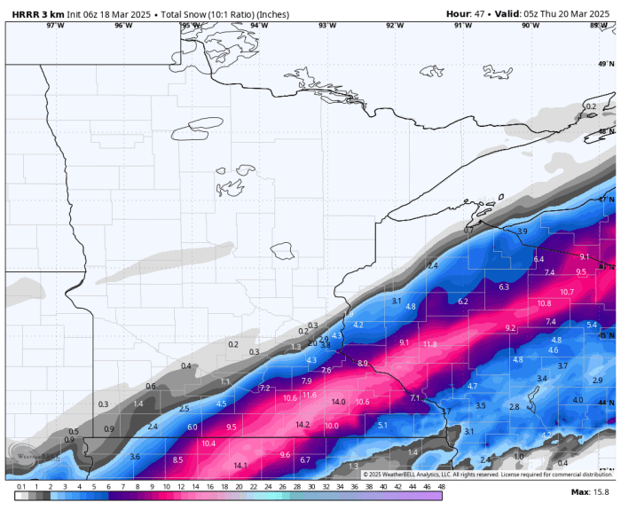
WeatherBell
NAM 3km model: Skunks the metro

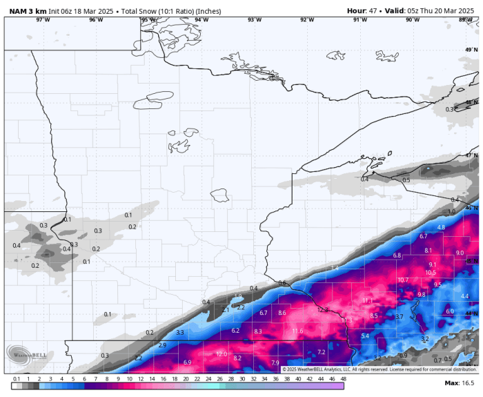
WeatherBell
European and Canadian models: 1-4 inches for the metro
SREF model: This one takes the average of the short-term models and it’s going 2-5 inches for the metro.
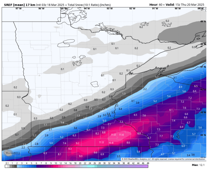
WeatherBell
The one model that continues to pummel the Twin Cities with snow is the American model, which has seemed out to lunch compared to the rest of its competition.
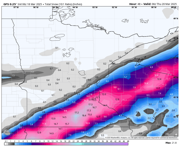
WeatherBell
Meteorologists have having a heckuva time forecasting this one for the Twin Cities. It has boom potential, but it may be more likely at this point that a bust occurs. We’ll have updates later Tuesday and again Wednesday morning.
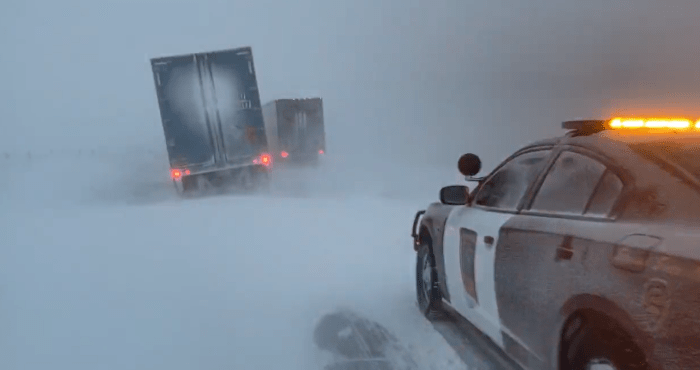
Stock image from a recent blizzard in Minnesota.
