MONTGOMERY, Ala. — A tornado watch is in effect until 1 a.m. CST for several Alabama counties, including Autauga, Baldwin, Butler, Chilton, Choctaw, Clarke, Conecuh, Covington, Crenshaw, Dallas, Elmore, Escambia, Greene, Hale, Lowndes, Marengo, Mobile, Monroe, Montgomery, Perry, Sumter, Washington, and Wilcox.
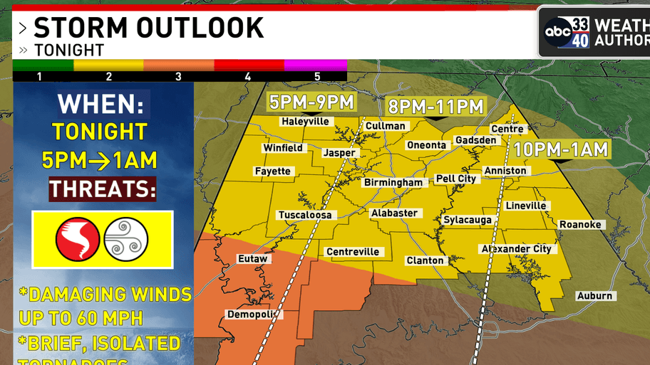
ABC 33/40 Chief Meteorologist James Spann said, “The core threat of isolated tornadoes and severe thunderstorms in Alabama tonight is over the southwest counties, where some surface-based instability is involved. The overall risk of severe storms over the northern half of the state is very low.”
Spann noted that gradient winds, unrelated to thunderstorms, are a significant concern statewide, with gusts reaching up to 45 mph. “Gusts are in the 30-40 mph range for most communities,” he said, adding that Montgomery reported a gust of 44 mph in the afternoon.
The Storm Prediction Center maintains an “enhanced risk” of severe thunderstorms across South Alabama, while most of the rest of the state is under a “slight risk.”

Key messages for tonight include the possibility of a brief, isolated tornado within the storm line, particularly in Southwest Alabama. Spann warned that “gradient winds will continue gusting to 45 mph,” which could bring down trees and power lines.
The National Weather Service in Birmingham has issued a wind advisory for all of Central Alabama until 3 p.m. CST Wednesday, with southwest winds of 20 to 35 mph and gusts up to 50 mph expected. The advisory warns that “gusty winds will blow around unsecured objects,” potentially causing power outages.
Residents are advised to secure outdoor objects and exercise caution while driving, especially in high-profile vehicles.